(If you meet downloading problem, please try this link, code:91ae.)
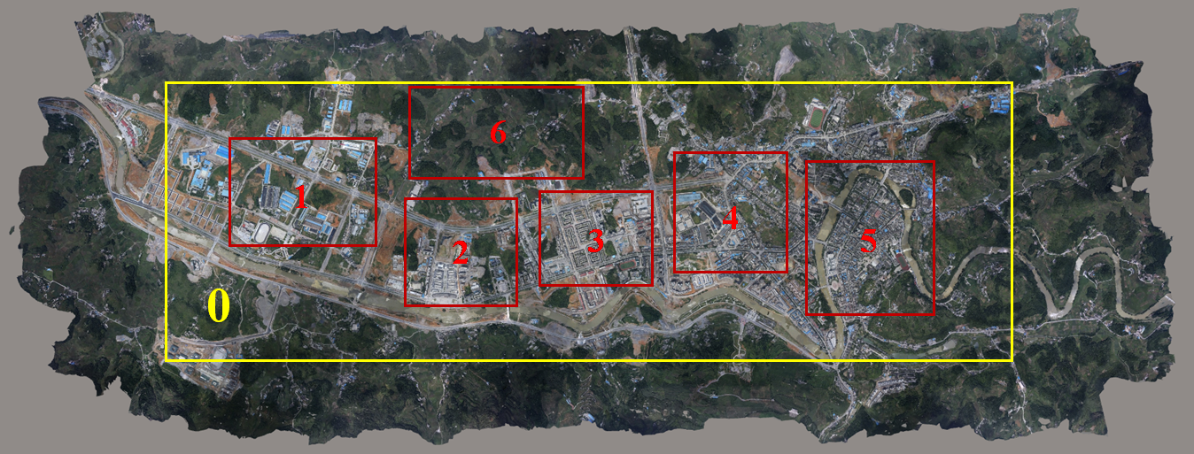
We created the synthetic aerial dataset for large-scale Earth surface reconstruction called the WHU dataset. The aerial dataset generated from a highly accurate 3D digital surface model produced from thousands of real aerial images and refined by manual editing, covering an area of 6.7×2.2 km2 over Meitan County, Guizhou Province in China with about 0.1 m ground resolution. The covered area contains dense and tall buildings, sparse factories, mountains covered with forests, and some bare ground and rivers.
The dataset includes a complete aerial image set with ground truth depths for multi-view matching and disparities for stereo matching. In addition, we provided the cropped sub-image sets for facilitating deep learning.
Paper: Link ;Code:Link.
1.The whole aerial dataset
We provided the whole aerial images and ground truth corresponding to the Aera 0 (yellow box). The virtual aerial image was taken at 550 m above the ground with 10 cm ground resolution. A total of 1,776 images (5376×5376 in size) were captured in 11 strips with 90% heading overlap and 80% side overlap, with corresponding 1,776 depth maps as ground truth. We set the rotational angles as (0,0,0), and two adjacent images therefore could be regarded as a pair of epipolar images. A total of 1,760 disparity maps along the flight direction also were provided.
Figure 1. The dataset.
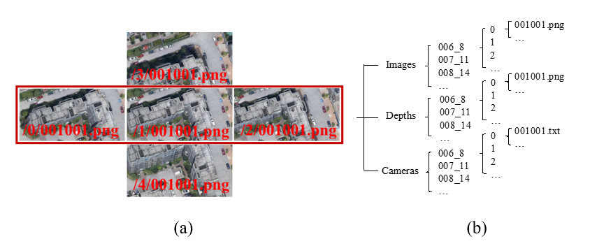
We provided 8-bit RGB images and 16-bit depth/disparity maps with the lossless PNG format and text files that recorded the intrinsic and extrinsic parameters. Please see the “README.txt” file for a detailed explanation.
1.The whole aerial images and camera parameters (57 G)
2.The ground-truth depths for multi-view stereo (17.8 G)
3.The ground-truth disparities for two-view stereo (22.6 G)
(If you need multi-view dataset, please download 1 and 2, which are images and ground-truth depths respectively; if you need two-view stereo dataset, please download 1 and 3.)
2.The cropped sub-dataset
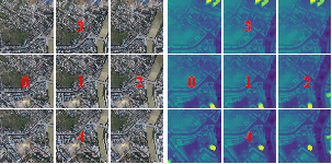
We selected six representative sub-areas covering different scene types as training and test sets. A total of 261 aerial images of Areas 1/4/5/6 (red box) were used as the training set, and 93 images from Area 2 and Area 3 (red box) comprised the test set. For a direct application of the deep learning-based methods on the sub-dataset, we additionally provided a multi-view and a stereo sub-set by cropping the virtual aerial images into sub-blocks.
下载
图示